Montreux sits on the Swiss side of the Alps; Chamonix, on the French side, sits in the shadow of the highest mountain in Western Europe. Chamonix-Mont-Blanc is close enough for a day out — a short drive or train ride through Martigny — and it hands you a cable car that climbs from the valley floor to 3,842 metres in about twenty minutes.[1]
Chamonix at a glance
- What
- Alpine resort town at the foot of Mont Blanc, Haute-Savoie, France — home of the Aiguille du Midi cable car[1]
- From Montreux
- About 81 km / 1h15 by car via Martigny; around 2.5–2.75h by train (Mont Blanc Express via Martigny and Vallorcine)[4]
- Aiguille du Midi
- Cable car from the town centre (1,033m) to the summit station at 3,842m in about 20 minutes[1]
- Mont Blanc
- The massif's summit is commonly cited at around 4,807m; precise glacier-surface surveys have ranged roughly 4,805–4,810m in recent years[3]
- Border
- France is in the EU: carry a passport or ID card; prices are in euros
- Allow
- A full day, leaving Montreux by about 08:00
Short answer: yes, Chamonix and the Aiguille du Midi work well as a day trip from Montreux — about 1h15 by car via Martigny, or roughly 2.5–2.75 hours by train with a change. Check the Aiguille du Midi's operating dates before you go: the lift closes between seasons, and for winter 2026–2027 it reopens on 19 December 2026.[2]
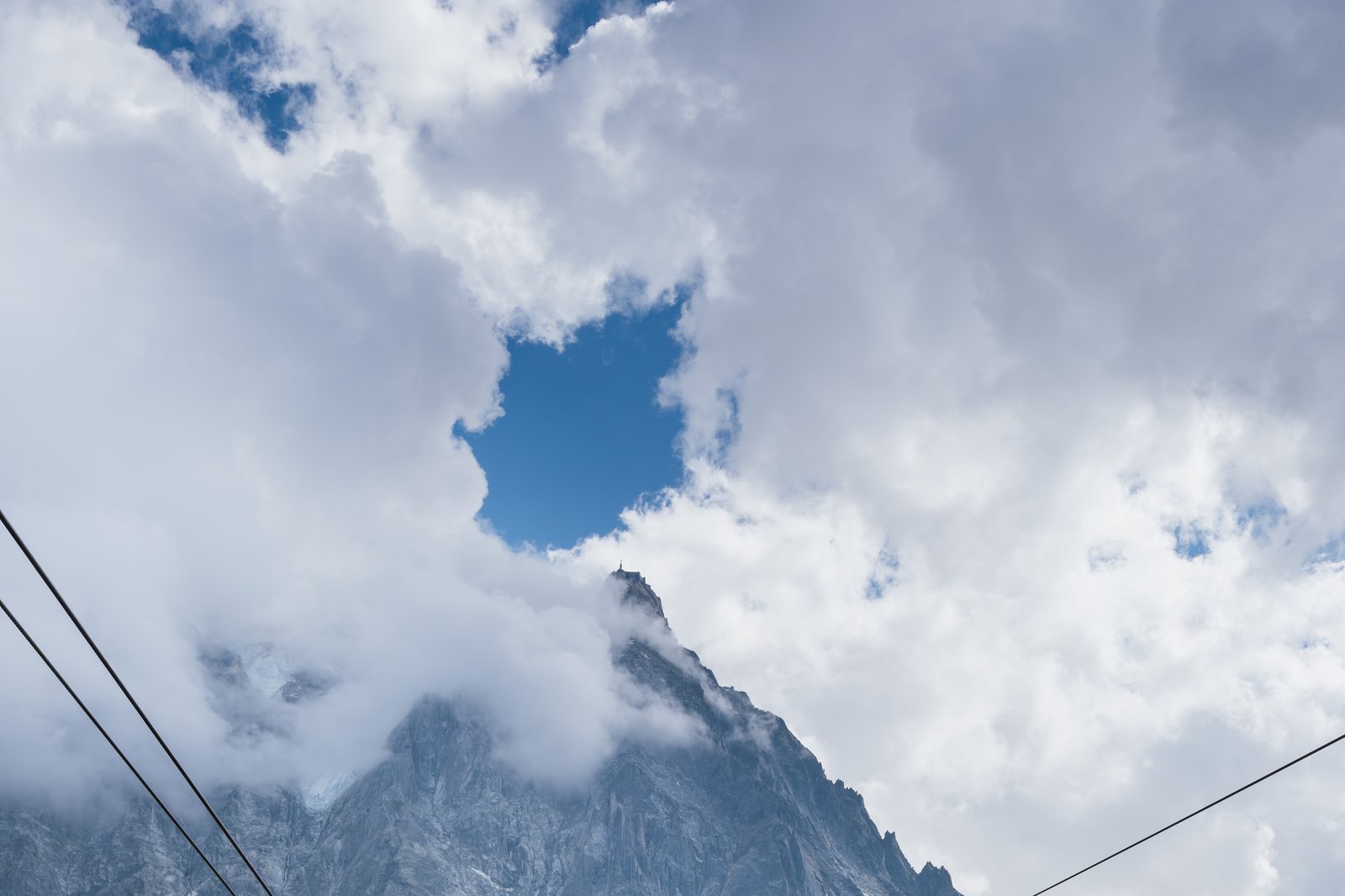
Photo: Christian David, CC BY-SA 4.0 (cropped), via Wikimedia Commons
In this guide
What Chamonix offers
Chamonix-Mont-Blanc has been a mountaineering and winter-sports town for well over a century, hosting the first Winter Olympics in 1924. The valley floor sits at around 1,033 metres, ringed by some of the highest peaks in the Alps, which is exactly what makes the Aiguille du Midi cable car such a draw: in twenty minutes it takes you from the town centre to the gates of the high mountains, at 3,842 metres, for a 360° panorama over the French, Swiss and Italian Alps.[1] The town itself is walkable, with a compact centre of shops, cafés and mountain-guide offices below the peaks.
Getting there from Montreux
By car, the route runs via Martigny and the Col de la Forclaz (or the Mont-Blanc tunnel approach in winter conditions), covering roughly 81 km in about 1 hour 15 minutes.[4] Without a car, the scenic option is the Mont Blanc Express, a narrow-gauge line that runs from Martigny to Chamonix via Vallorcine. From Montreux, that means an SBB train to Martigny, then the Mont Blanc Express onward; door to door the trip typically runs around 2.5 to 2.75 hours, with one or two changes depending on the connection.[4] Compare train passes in our Swiss Travel Pass vs Half Fare Card guide — note that French rail tickets for the Vallorcine–Chamonix leg are bought separately.
The Aiguille du Midi cable car
The Aiguille du Midi cable car has carried visitors above Chamonix for more than 60 years, lifting them from the valley station to the summit station at 3,842 metres in about 20 minutes, with a midway stop at Plan de l'Aiguille (2,310m) that doubles as a hiking trailhead in summer.[1] At the top: a 360° summit terrace, the glass-floored “Step into the Void” platform, and on a clear day a direct view across to Mont Blanc itself.[1]
Source check, winter 2026–2027: the cable car's official timetable lists operation from 19 December 2026 to 28 March 2027, and again from 29 March to 30 May 2027; outside those windows it is closed for maintenance. Adult round-trip fares run from €60.20 to €83.00 depending on the date, with reservation free but required. Source: aiguilledumidi.montblancnaturalresort.com (official), checked November 2026.[2]
Mont Blanc and the massif
Mont Blanc is the highest mountain in the Alps and in Western Europe, straddling the France–Italy border just south of the Aiguille du Midi. Its exact elevation is not a fixed number: geologists at the Haute-Savoie land-survey office remeasure the summit roughly every two years because the ice and snow cap that forms its highest point shifts with snowfall and glacier conditions, and measurements over the past two decades have ranged from about 4,805 to 4,810 metres.[3] Most references settle on a figure of roughly 4,807 metres as the commonly cited height.[3] You don't need to summit it to see it: the Aiguille du Midi terrace and the valley's many viewpoints put the whole massif in front of you without the climb.
When to go
Summer (June–September) gives the longest opening hours, full access to Plan de l'Aiguille's hiking trails, and the best odds of a clear summit view, but also the busiest queues — the online reservation for the cable car is free but required year-round.[2] Winter opens the Aiguille du Midi to a different crowd: skiers and off-piste groups using it as a lift to high-mountain routes. The cable car is closed for a shoulder-season maintenance break each spring and autumn, so always check the live schedule before planning the trip — see our Glacier 3000 guide for a comparable high-altitude outing that stays on the Swiss side when the Chamonix lift is shut.
Where to stay
Chamonix makes a full day out rather than a base for a Montreux stay: you are back on the Vaud Riviera lakefront in the evening, car-free if you came by train. For another high-Alps day trip from the apartment, see our Zermatt & the Matterhorn guide, or stay on the rails with the GoldenPass Express to Interlaken.
Base yourself in Montreux
Chamonix, Zermatt and Interlaken are all a train or a short drive away. A kitchen for early starts and the lakefront when you get back.
See our apartmentsRelated reading: Zermatt & the Matterhorn · Glacier 3000 · Swiss Travel Pass vs Half Fare

10+ years in hospitality. BBA Hospitality (Glion), MSc Tourism (FHGR), MSc Data Science (HSLU).
Frequently asked questions
How long does it take to get from Montreux to Chamonix?
By car via Martigny it is about 81 km and roughly 1 hour 15 minutes. By public transport, the Mont Blanc Express connects via Martigny and Vallorcine, and the whole journey typically takes around 2.5 to 2.75 hours with a change or two.[4]
Is the Aiguille du Midi cable car open now?
Check before you go: the lift closes for maintenance between seasons. For winter 2026-2027 the official schedule lists operation from 19 December 2026 to 28 March 2027, with a further season from 29 March to 30 May 2027.[2]
How high is the Aiguille du Midi?
The upper cable car station sits at 3,842 metres, reached in about 20 minutes from the valley station in central Chamonix at 1,033 metres.[1]
Do I need a passport to visit Chamonix from Switzerland?
Carry a valid passport or national ID card. Switzerland and France are both in the Schengen area, but identification is still required, including for the return journey.
What currency is used in Chamonix?
Euros. Cards are widely accepted in Chamonix, including at the Aiguille du Midi ticket office, but carry some cash for smaller cafés.
Sources
- Chamonix Tourist Office (en.chamonix.com) — Aiguille du Midi cable car: altitude 3,842m, 20-minute ride from the 1,033m valley station — en.chamonix.com
- Compagnie du Mont-Blanc, official Aiguille du Midi site — winter 2026–2027 operating dates and fares — aiguilledumidi.montblancnaturalresort.com
- Wikipedia — Mont Blanc elevation, recent survey range — en.wikipedia.org/wiki/Mont_Blanc
- Rome2Rio route data (SBB/SNCF/TMR operators) — Montreux–Chamonix drive distance and train journey time via Martigny and Vallorcine — rome2rio.com